
Hydrogeologic Framework of the Mesilla Basin Region
of New Mexico, Texas, and Chihuahua (Mexico)—
Advances in Conceptual and Digital-Model Development
Abstract
This Report describes the results of the latest of a series of NM Water Resources Research Institute investigations that provide state-of-practice information on the hydrogeologic-framework of intermontane basins of the Mesilla Basin region (MBR) that are linked by the valleys and canyons of the Rio Grande, and includes parts of New Mexico, Trans-Pecos Texas, and Chihuahua (MEX). Work in a 3,350 mi2 (8,675 km2) binational/tristate Study Area gets special emphasis. Effective conservation of the region’s large, but still finite low-salinity groundwater resources, requires detailed hydrogeologic characterization of basin- and valley-fill deposits. Major advances in geographic information systems science and technology during the past two decades have permitted substantial progress in this research area. Of special note are the advances in the conceptual- and digital-model development that have occurred since publication of work completed prior to 2005.
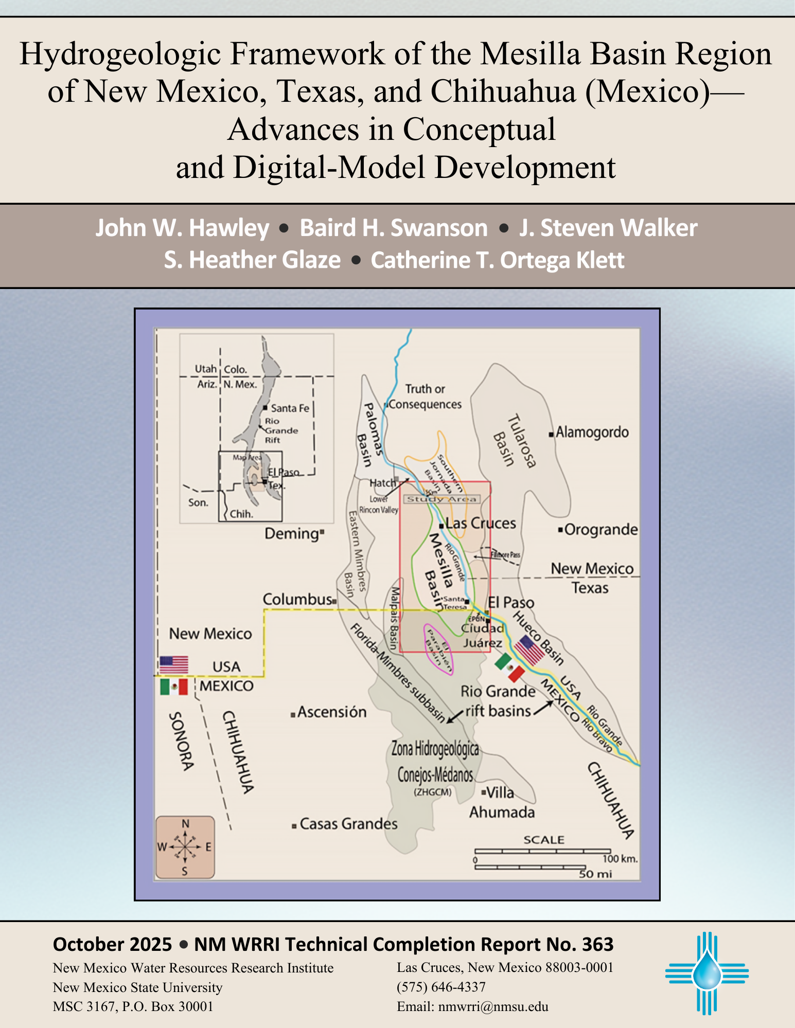
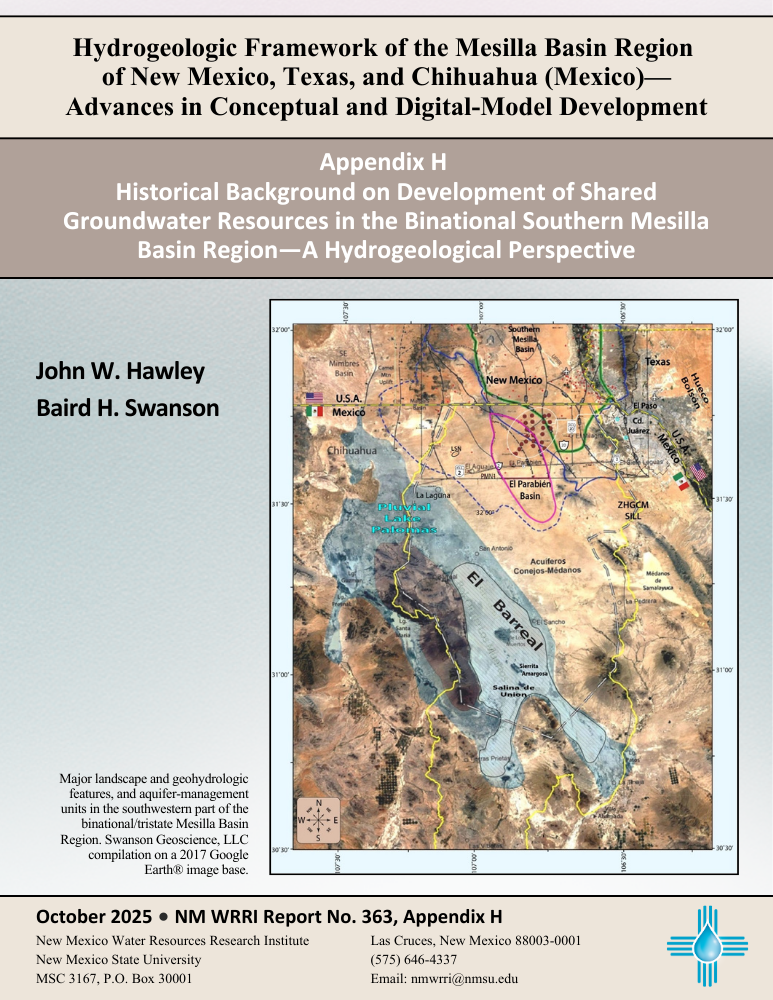
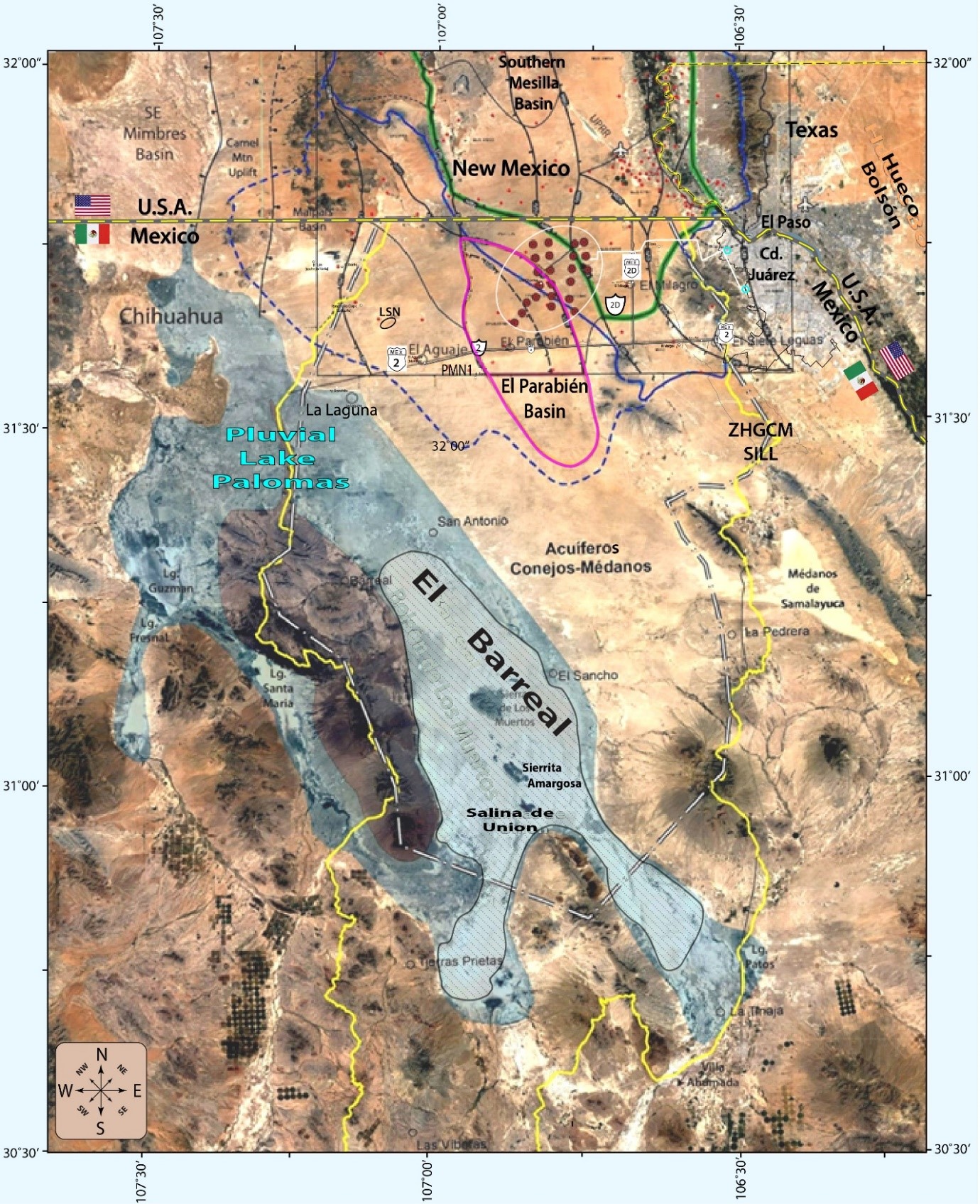
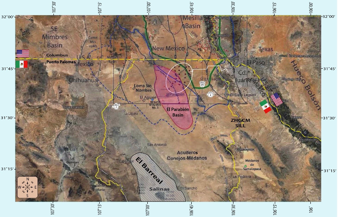
The Mesilla Basin and the Mesilla Valley of the Rio Grande are located near the southern end of the Rio Grande rift tectonic province and in the southeastern part of the Basin and Range (B&R) physiographic province. Parts of the MBR below an altitude of about 5,000 ft (1,525 m) amsl are also in the arid to semiarid Chihuahuan Desert ecoregion. The Study Area, as defined herein, includes the Mesilla Basin and hydrologically linked parts of three other large RG-rift basins: (1) the Southern Jornada [del Muerto], New Mexico, (2) the western Hueco Bolson, mostly in Texas and Chihuahua, and (3) the recently identified El Parabién Basin, Chihuahua, Mexico. Rift-basin fill of the Upper Cenozoic Santa Fe Group, and Quaternary alluvium in the inner valleys of Rio Grande/Bravo fluvial system comprise the only significant aquifer systems throughout the MBR.
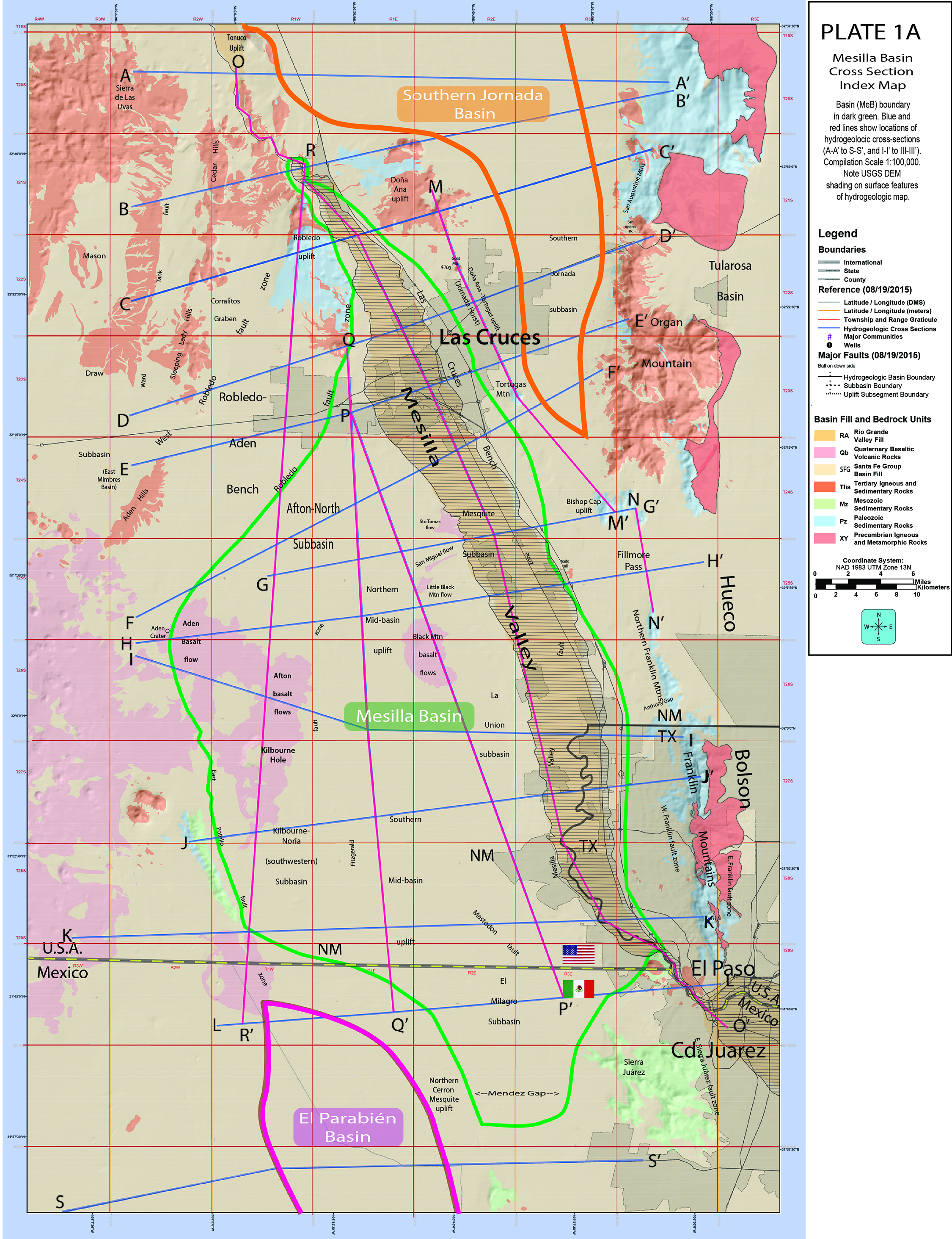
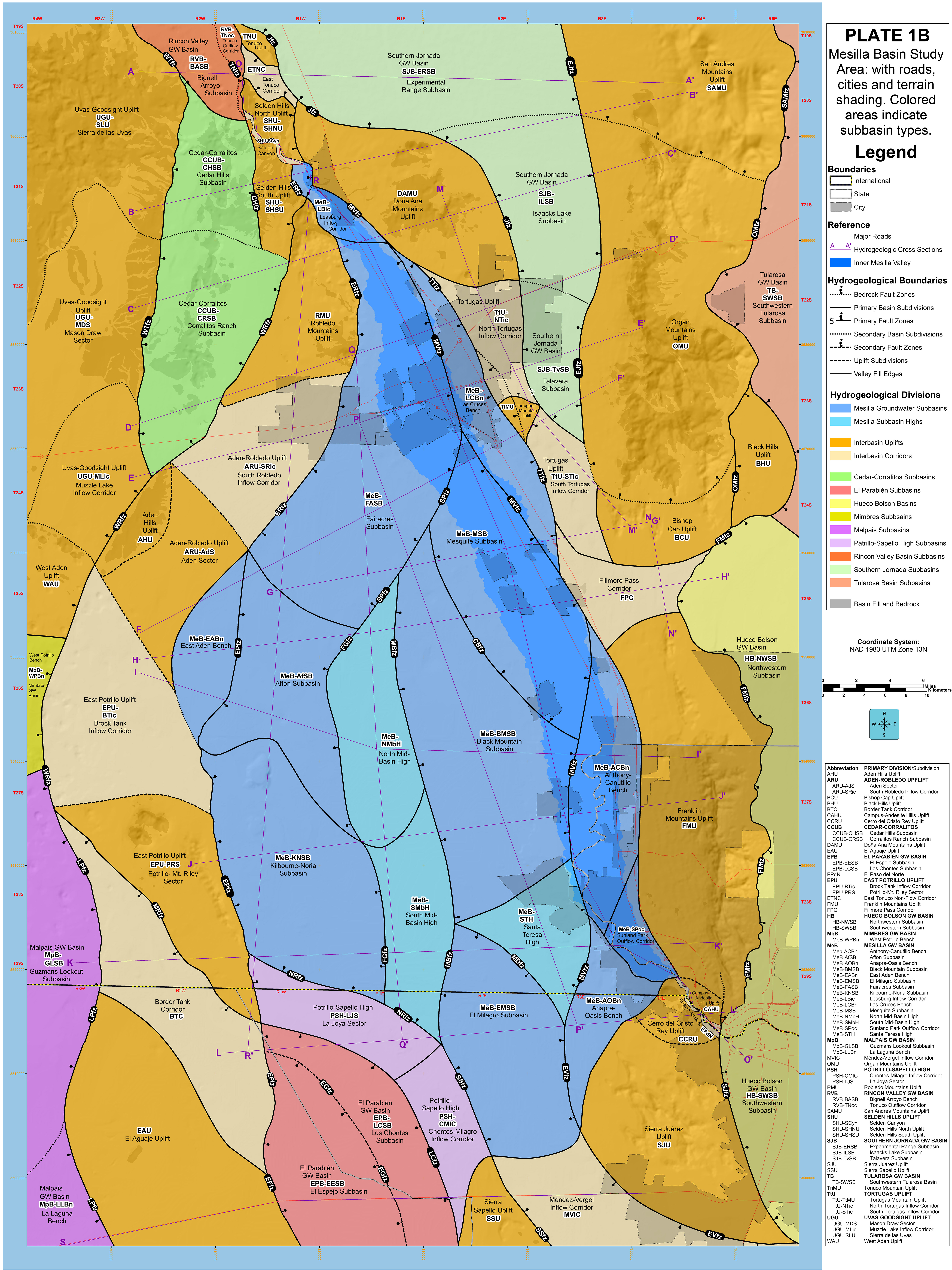
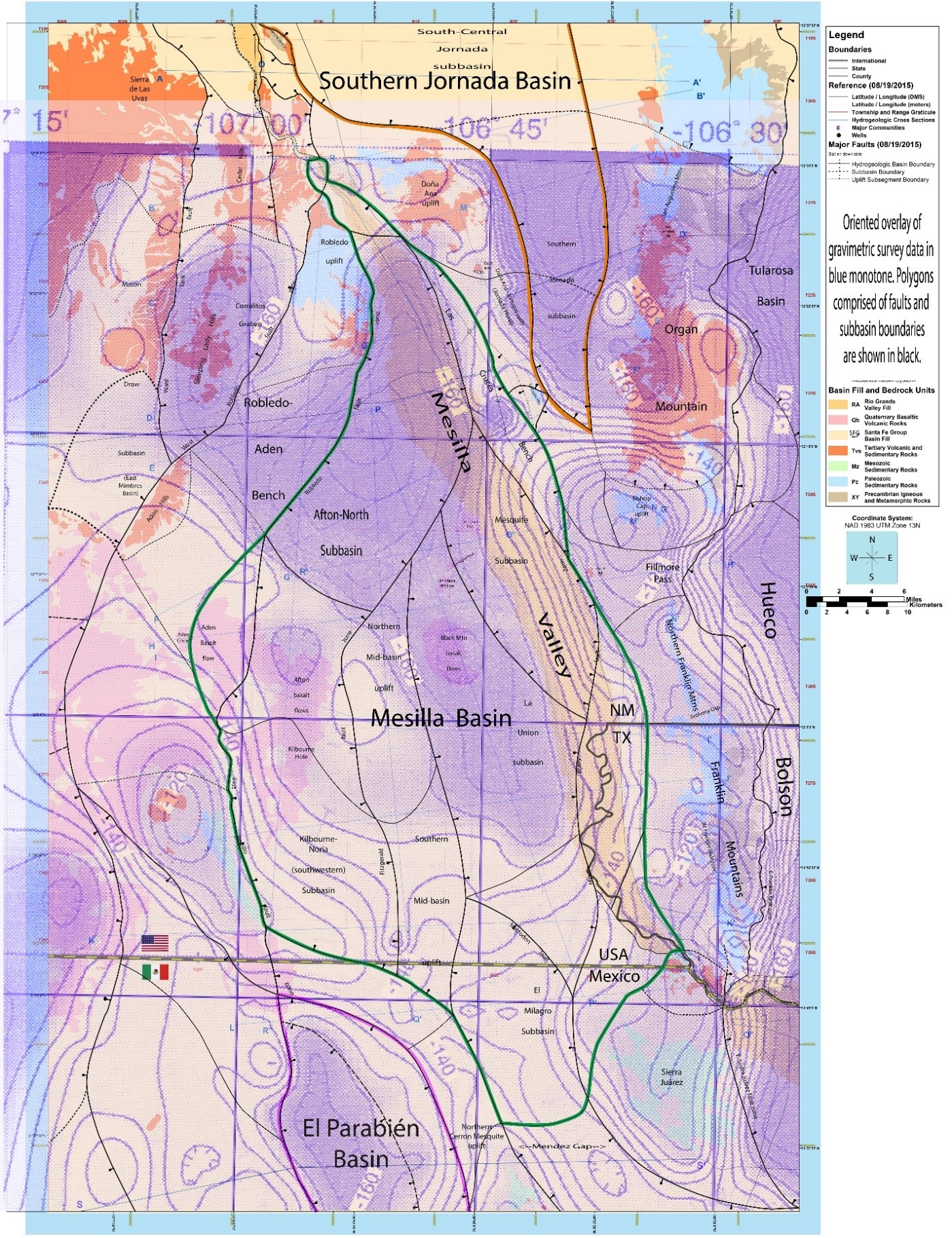
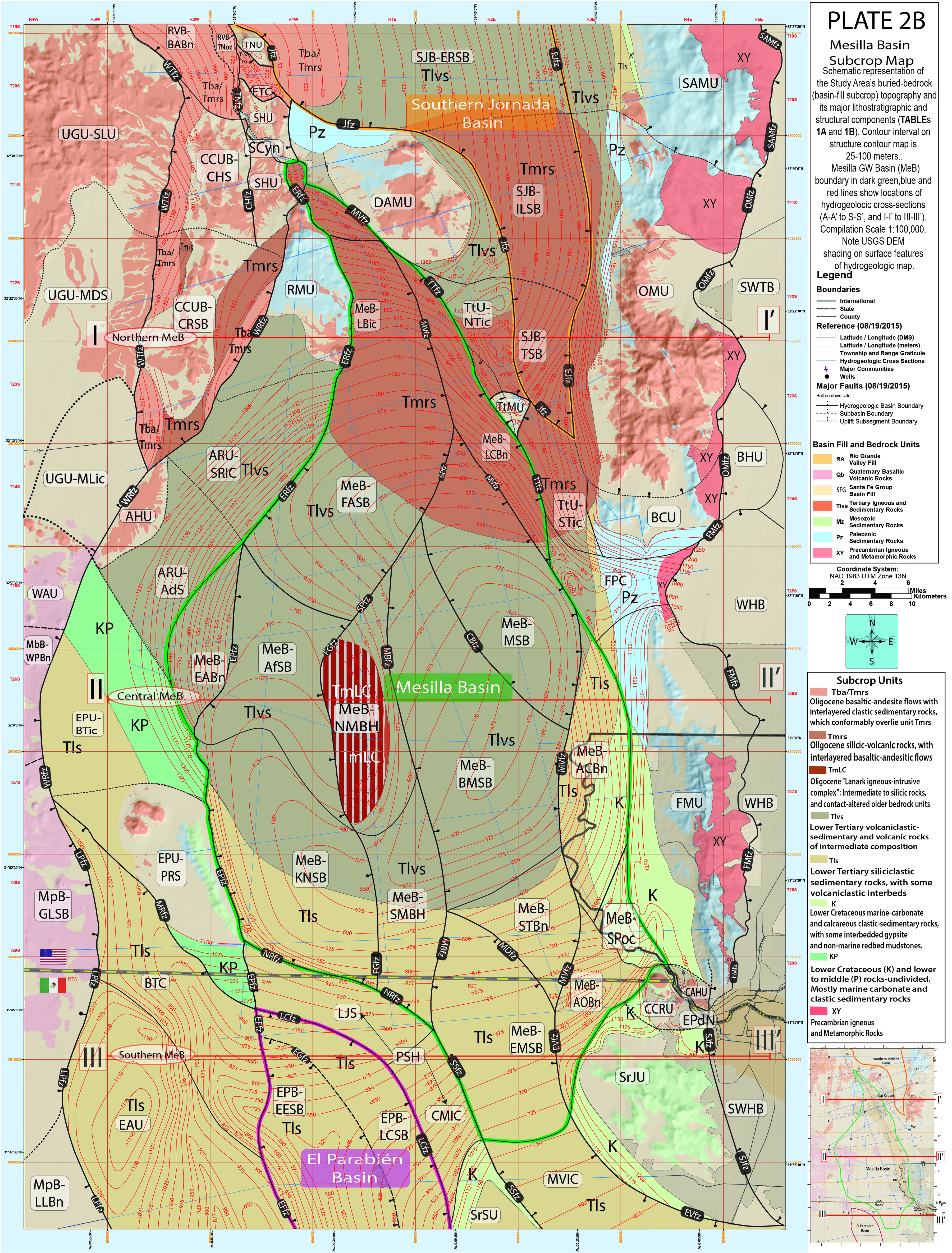
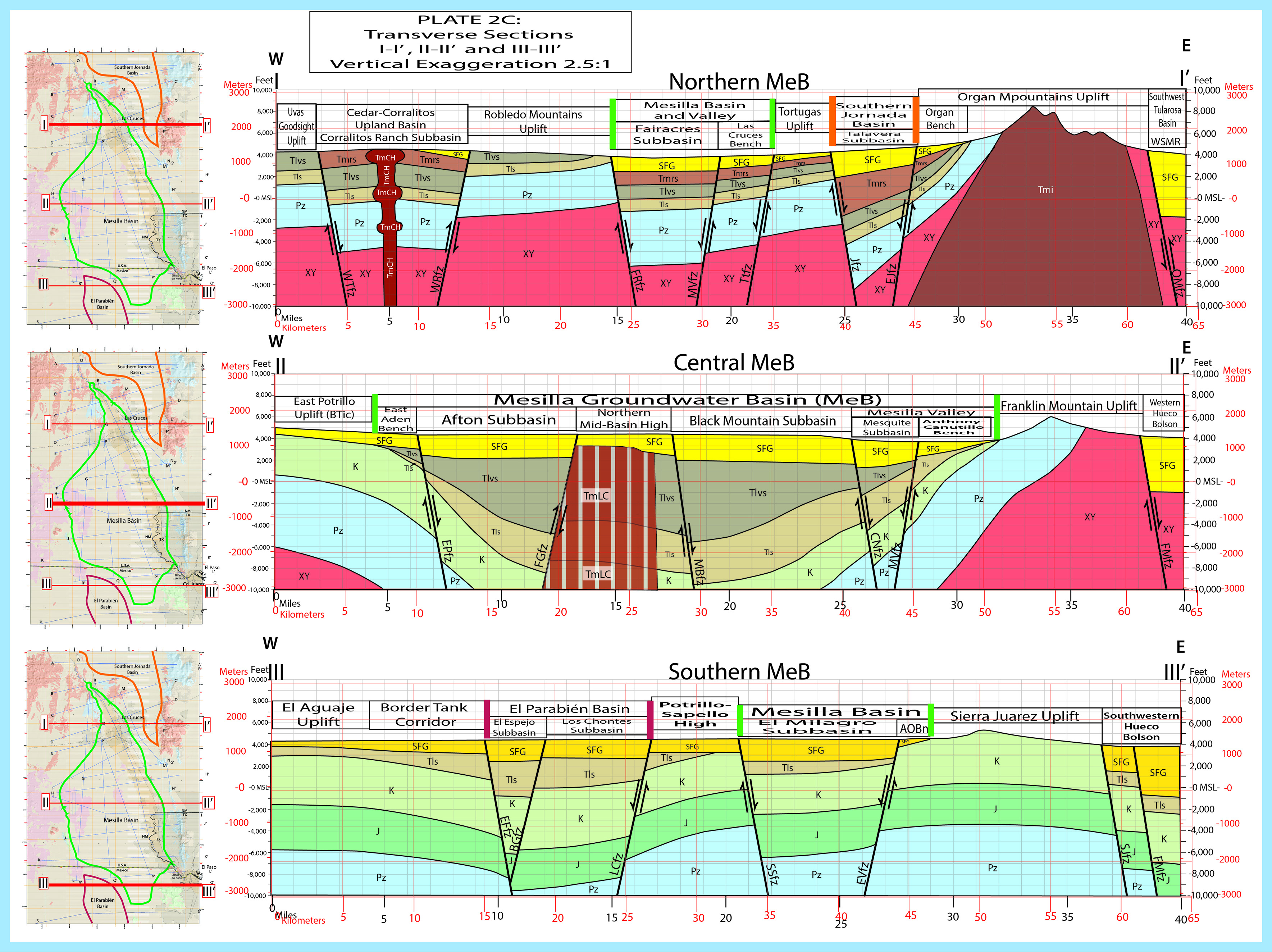
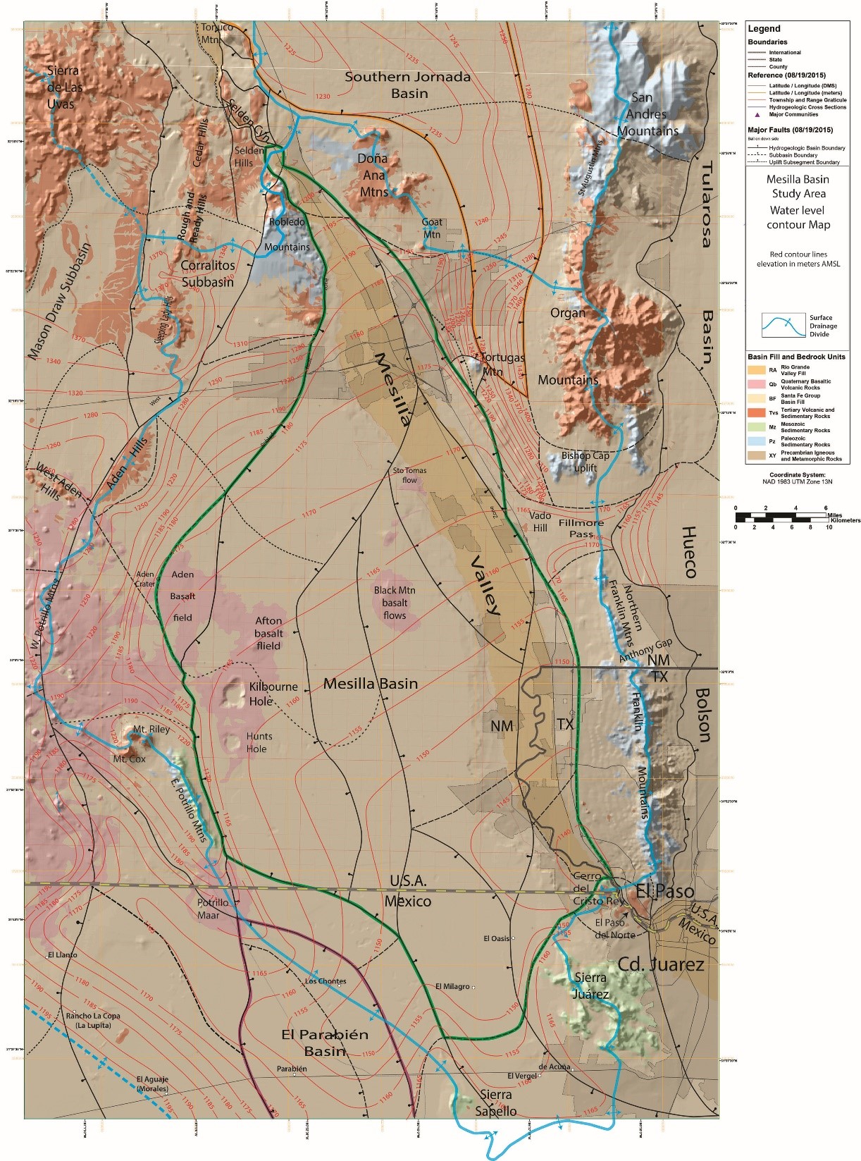
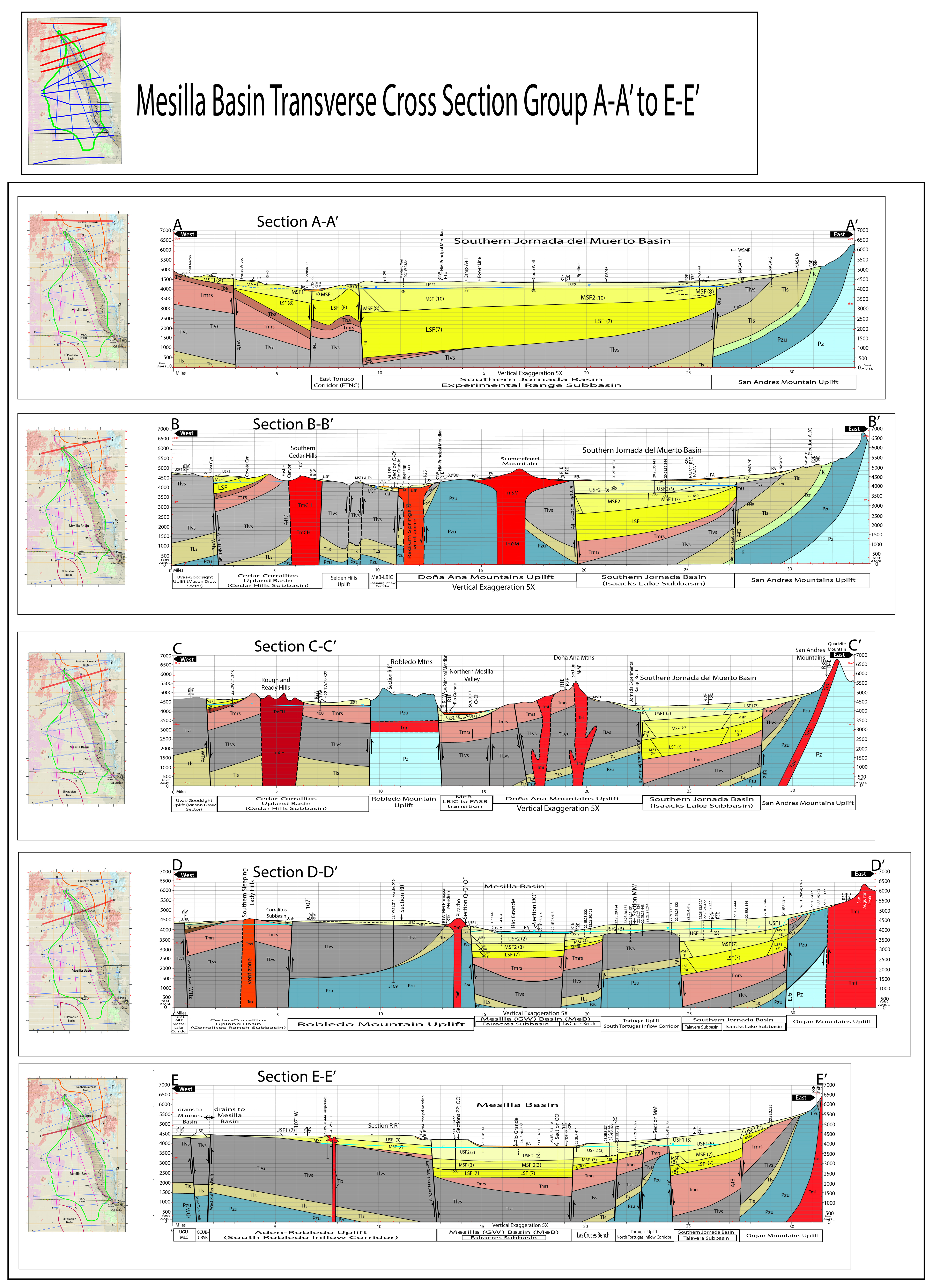
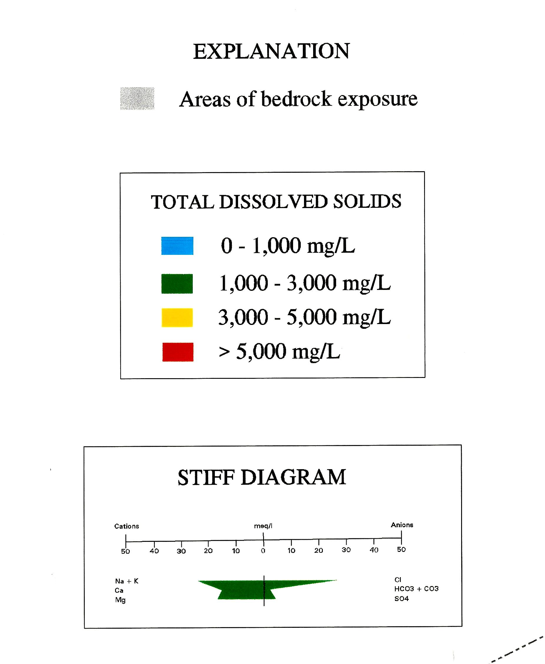
Three-dimensional portrayal of the basin-scale (~1:100,000) hydrogeologic framework has been the primary contribution of this investigation. Many illustrations had to be initially designed and manually compiled by the Principal Investigator (PI), and reflect his field-based experience in the MBR that dates back to the 1960s. From this perspective, conceptual design and preparation of the Report’s maps (8), cross-sections (19), and block diagrams (2) has been a mind-expanding iterative process. It has involved the input of dozens of individuals, including highly skilled cartographers. Concepts and assumptions in map, cross-section, and block-diagram preparation are derived from the large body of public-domain information, most of which is adequate for basin-scale hydrogeologic-framework characterization (Appendices A and C to E). Major components of this database include information on (1) surficial geomorphic and geologic relationships, (2) subsurface stratigraphy and structure, and (3) geophysical and hydrochemical conditions. The body of the Report and its eight Appendices, for example, are supported by almost 1,000 source documents in the compilation of Cited References, and an expanded Glossary of geoscientific terms (Appendix G) has over 250 entries. With respect to the interpretation of geomorphic processes and landscape features alone, the current generation of Google Earth® image products, and space-platform imagery in general have played an essential role in map preparation, particularly in the Mexican part of the Study Area (cf. Appendices F and H).
Download Files
Technical Report 363 (Last updated: 3-2-26)
Hydrogeologic Framework of the Mesilla Basin Region of New Mexico, Texas, and Chihuahua (Mexico) — Advances in Conceptual and Digital-Model Development
📄 Download Technical Report 363 (PDF)Appendices, plates, and tables associated with this technical report.
PDFs available to be downloaded
Tip: Some files may take a few moments to load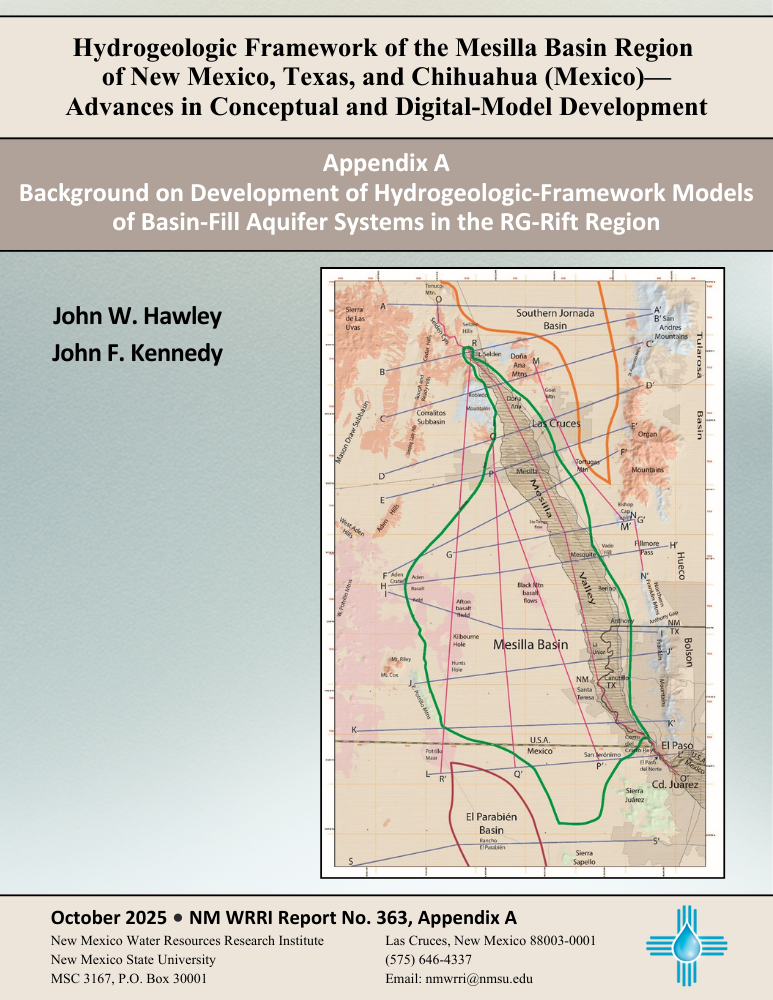
Plates & Tables
- PLATE 1 Series Titles
- PLATE 2 Series Titles
- PLATE 3 Index Map Showing Locations of the 395 Key Wells
- PLATE 4 Title
- PLATE 5 Title
- PLATE 6 Title
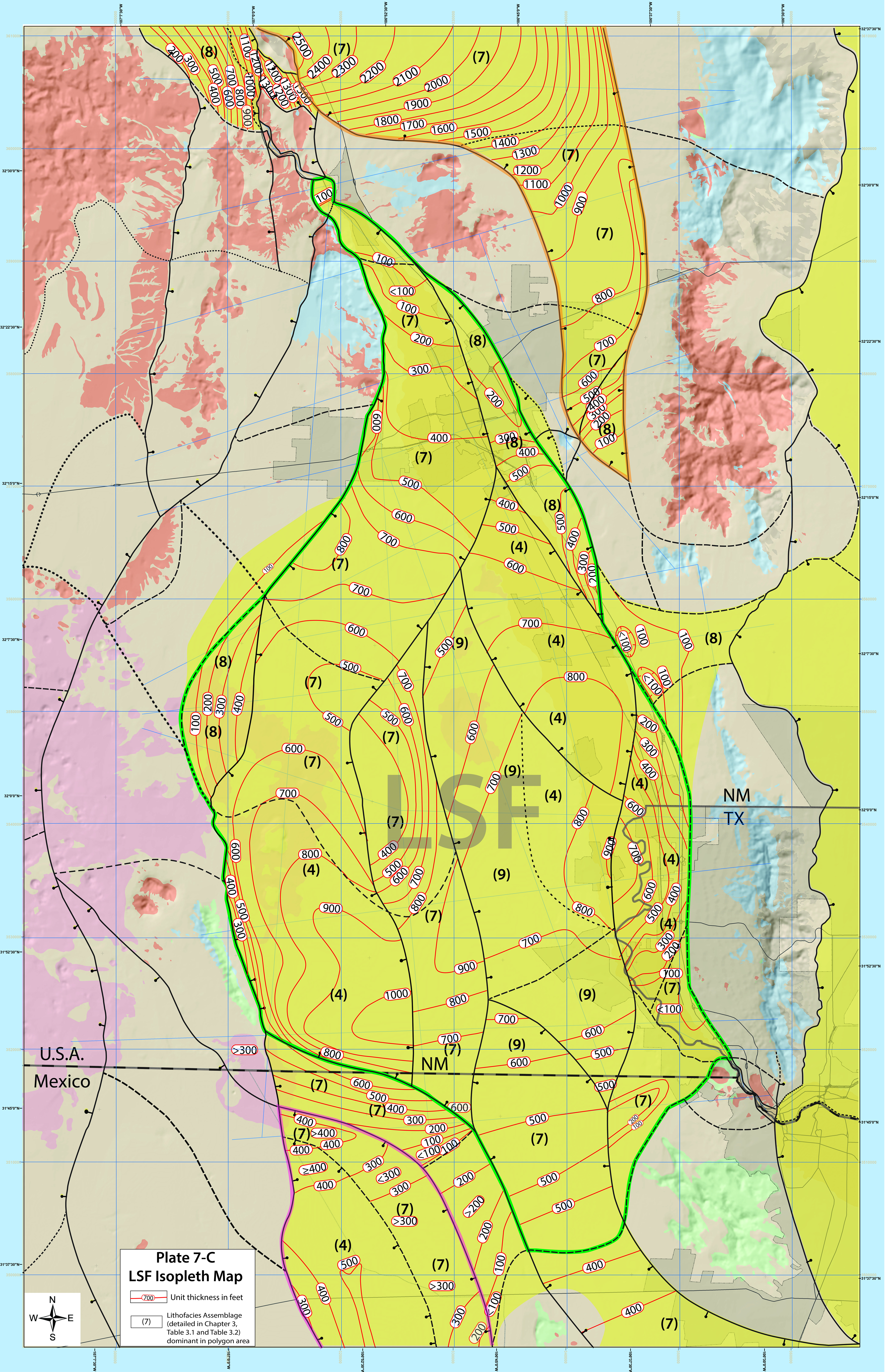
- PLATE 7 Title
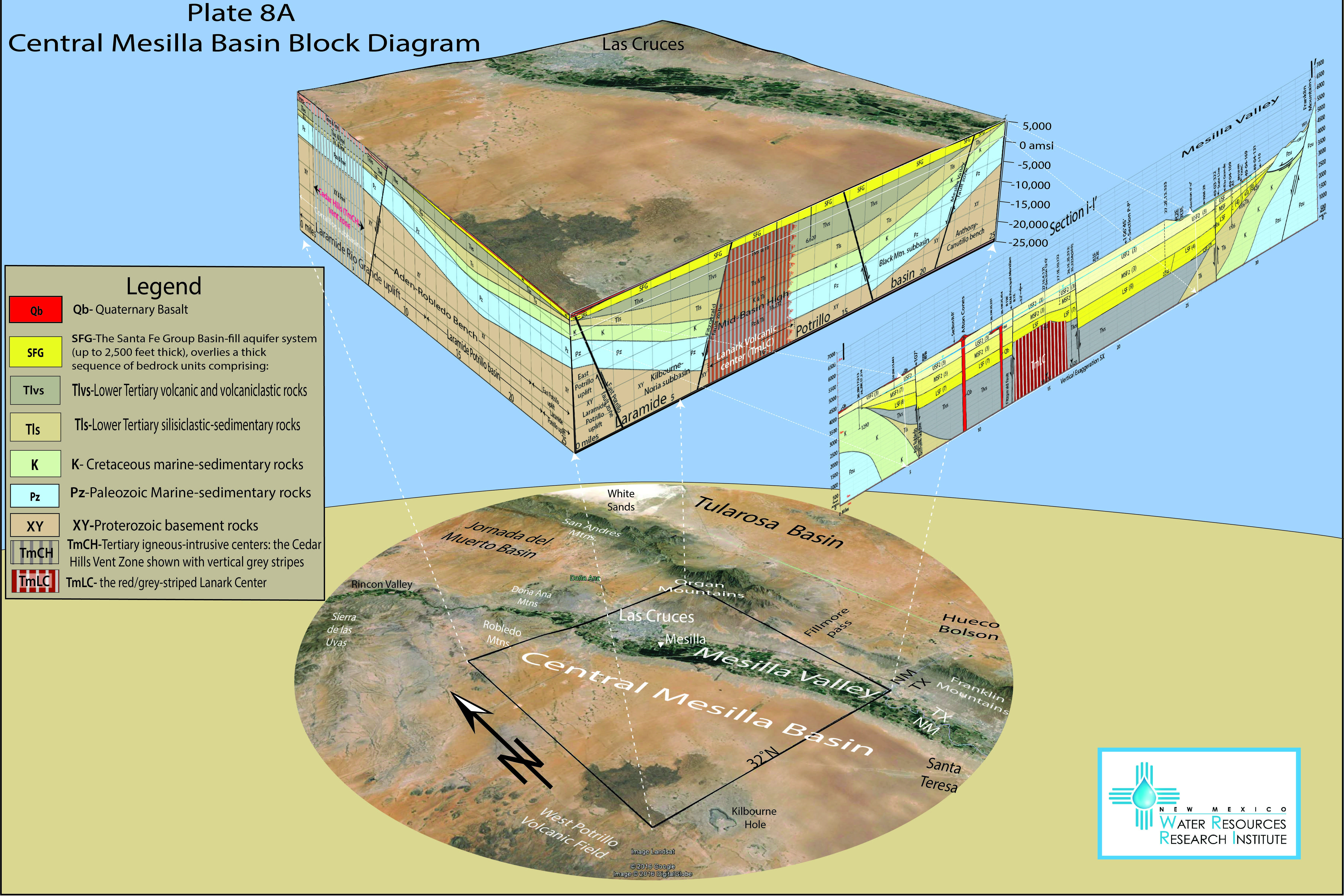
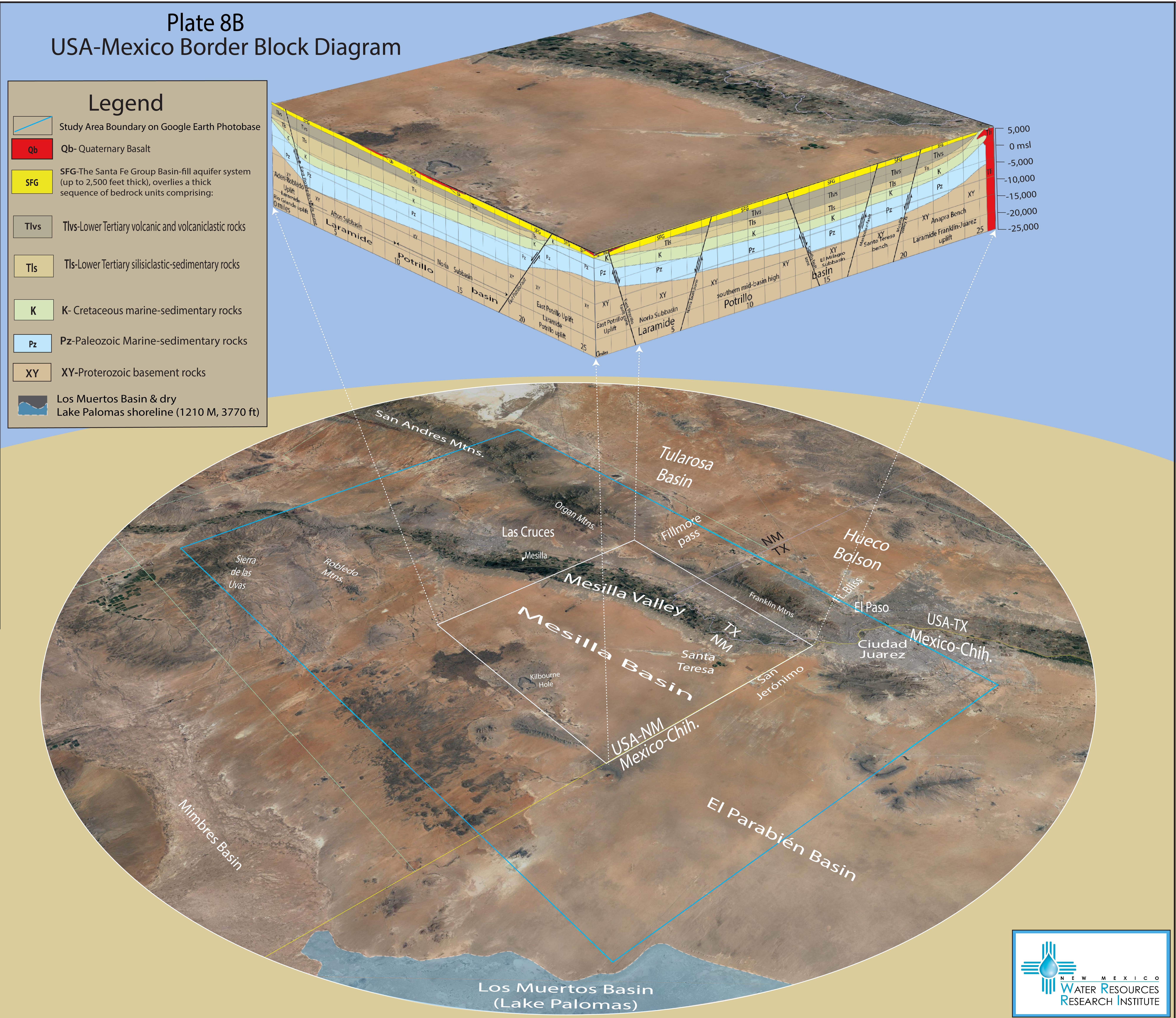
- PLATE 8 Series Titles
- PLATE 9 Series Titles
- PLATE 10 Title
- PLATE 11 Title
- PLATE 12 Title
- TABLE 1
- Key_Wells_Table (PDF)
- Key_Wells_Table_GIS (Excel)
This file is an Excel spreadsheet download.
- MBR Key Wells and Hydrogeology.zip
How to view (KMZ):
- Download the ZIP file above to your computer.
- Open Google Earth and choose New (or File).
- Select Open local KML file.
- Choose the downloaded KMZ file.
- TABLE 1A
- TABLE 1B
- TABLE 2
- TABLE 3A
- TABLE 3B